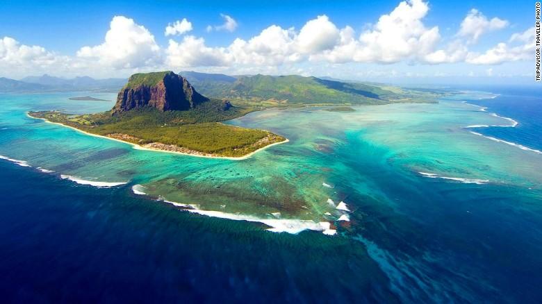
With today’s satellite technology, one would expect for major land masses to be charted and accounted for. However, some large geographic features apparently remain hidden. A team of South African geoscientists recently reported in Nature Communications that they discovered a lost continent that has sunken deep in the Indian Ocean. Located underneath the island of Mauritius near Madagascar, the lost continent has been given the name Mauritia.
Scientists believe that 200 million years ago, this lost continent was originally a part of the supercontinent Gondwanaland, which formed much of the Southern Hemisphere as we know it today, including present day Africa, South America, Antarctica, India and Australia. The Northern Hemisphere continents were originally formed by the supercontinent Laurasia. Together, Laurasia and Gondwanaland formed the single supercontinent Pangaea 335 million years ago.
Geoscientists propose that Pangaea and other supercontinents broke apart because of mantle plumes. The theory suggests that these large amounts of hot rock rose from the mantle, one of Earth’s deeper layers. As it rose to the superficial layers, the hot rock softened the tectonic plates, which make up Earth’s crust. These softened spots broke apart, creating volcanic centers known as hot spots which can lead to the formation of separate land masses.
It is believed that Mauritia once connected Madagascar and the subcontinent of India 85 million years ago. Scientists estimate that Mauritia was about a quarter of the size of Madagascar. As Madagascar and India started to move and pull away from one another, Mauritia began to stretch, eventually falling apart.
Martin Van Kranendonk, professor of biological earth and environmental science at the University of New South Wales in Australia, likened the historic event to molding clay that is stretched beyond its limit. “It’s like plasticine: when continents are stretched they become thinner and split apart,” said Kranendonk in an interview with New Scientist. “It’s these thin pieces that sink below the ocean.”
Scientists first became interested in investigating this island after learning that some areas in the Indian Ocean, including the island Mauritius, had stronger gravitational fields.Since the gravitational pull on Earth’s crust can vary depending on the density of the crust’s material, researchers hypothesized that a previously undiscovered continent was resting below Mauritius, which likely contributed to its strong gravitational field.
In an earlier investigation carried out in 2013, researchers found samples of an ancient mineral known as zircon in beach sand on the island of Mauritius. Zircon contains lead and uranium, which have isotopic properties that can be used in radiometric dating to determine the age of the rocks.
To their surprise, the researchers found that some of the sand zircon crystals were 660 million and 2 billion years old. This finding seemed out of place with the rest of Mauritius’ geology as the island itself is considered relatively young and was believed to be eight million years old.
To explain the juxtaposition, researchers hypothesized that the data may be evidence for the existence of an ancient continent that has now sunk into the sea and attached to the oceanic crust directly below Mauritius. Critics were quick to refute the hypothesis and predicted that the zircon crystal may have been carried by wind or the ocean and serendipitously ended up on the beaches of Mauritius.
In the most recent study, researchers studied volcanic rock taken from a visually exposed rock deposit in Mauritius. Researchers crushed the rocks and extracted zircon from the samples, deducing that the minerals are up to 3 billion years old.
Researchers suggested that the zircon may have been brought up onto dry land as a result of undersea volcanic eruptions that ejected older rocks from the subsurface crust. The crust is the outermost layer of the Earth and is also the thinnest layer measuring from zero to 60 km thick. Composed of dynamic tectonic plates, the crust is most affected by earthquakes and volcanoes along plate boundaries. Thus, an eruption caused by plate movement affecting the oceanic crust can bring up rocks and other artifacts from the terrestrial crust.
Scientists believe that there are many undiscovered remnants from Gondwanaland at the bottom of the ocean basin. They hypothesize that there may be other remnants from Mauritia underneath the volcanic islands of Cargados Carajos, the Laccadives and Chagos island. Researchers have also uncovered other lost continents off the coast of western Australia and underneath Iceland.
The discovery of Mauritia has not only revealed the possibility of unearthing other lost continents. It has also highlighted the methods scientists use today to reconstruct and evaluate how continents formed and broke apart thousands of years ago, demonstrated through their use of radiometric dating and examination of gravitational fields.


